
Buying land in Concord can be a smart, long-term move, but the rules that shape what you can build are not always obvious from a quick drive-by. Between wetlands, historic preservation, septic standards, and frontage rules, you want clarity before you write an offer. In this guide, you will learn the zoning and conservation basics that matter most, where to verify each item, and how they affect feasibility, timing, and resale. Let’s dive in.
Why Concord land is different
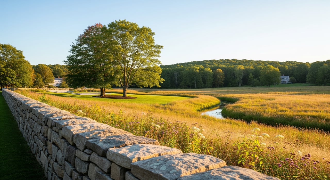
Concord sits at the confluence of the Concord and Assabet Rivers and includes a large amount of conserved open space. That means many parcels interact with wetlands, riverfront buffers, or mapped flood zones. Historic preservation is also prominent, and some properties fall within local historic districts or have recorded historic covenants.
Outside the walkable downtown core, many homes rely on private wells and septic systems. If you plan to build or expand, Title 5 septic standards and well permitting can shape design and costs. Start your research on the Town of Concord website, which links to Planning and Zoning, the Conservation Commission, Board of Health, Assessors, ZBA, Town Clerk, and the Building Department.
Zoning basics in Concord
Confirm your zoning district
Your zoning district sets the foundation for what is possible. It determines allowed uses, minimum lot area, frontage, setbacks, height limits, and lot coverage. Use the Town’s zoning map and bylaw to identify the district and any overlays, then confirm any recent amendments.
Pull the Assessors’ parcel card for lot area and frontage recorded on the plan. Also note if the lot is listed as nonconforming. The zoning framework sits under the Massachusetts Zoning Act, M.G.L. c.40A, which governs how local bylaws operate.
Uses and permits
Check whether your intended use is allowed as of right or by special permit. Single-family is common, but multi-family, accessory dwelling units, agriculture, or home occupations may have different paths. Some projects require special permits from the Planning Board or the Zoning Board of Appeals.
If your plan does not meet the bylaw, you may need a variance from the ZBA. Variances are discretionary and can be difficult to obtain. Lots that rely on special permits or variances are also harder to finance until approvals are in place.
Dimensional rules that shape a lot
Minimum frontage and what counts as frontage matter. Many bylaws require frontage on a public, accepted road. If frontage is on a private way, confirm legal access and maintenance rights, and whether the frontage qualifies for a building lot.
Setbacks, height limits, and lot coverage can push building envelopes away from boundaries and resource areas. If a lot is legally nonconforming, there are specific rules for alterations. Ask the Building Department how Concord applies these standards.
Overlays and historic constraints
Overlay districts can add rules for floodplain, groundwater, or scenic roads. In addition, some areas fall within local historic districts, where exterior changes can require approvals. Overlays and historic standards influence placement of structures, utilities, and site work.
Review Planning and ZBA minutes and past decisions for similar cases. This helps you anticipate local conditions that are likely to be attached to permits.
Subdivision and nonconforming lots
If you plan to divide land, study subdivision regulations and frontage standards early. Environmental constraints and minimum lot sizes can limit how many buildable lots are realistic. Engage a land surveyor to test potential layouts before making assumptions about yield.
For lots that do not meet current standards but predate zoning, nonconforming status can preserve some rights. The details are highly fact-specific, so verify with the Building Department and Planning staff before you rely on it.
Conservation and wetlands checks
Wetlands and riverfront buffers
Under the Massachusetts Wetlands Protection Act and local bylaws, regulated resource areas include bordering vegetated wetlands, banks, riverfront area, and bordering land subject to flooding. Wetland buffers commonly extend 100 feet from the boundary of a wetland, and riverfront areas can extend up to 200 feet from a river.
If your parcel touches these areas, many activities require Conservation Commission review. Expect to provide a wetland delineation by a qualified scientist and an engineered plan if you propose work within buffers. Local bylaws can be more restrictive than state law, so check the Conservation Commission’s records for any prior filings on the parcel.
Floodplain and insurance
Use FEMA’s maps to see whether any portion of the lot is in a Special Flood Hazard Area. Flood zones can trigger specific design standards and, for some loans, flood insurance. Start with the FEMA Flood Map Service Center to locate your property and map panel.
Note that floodplain boundaries can affect placement of structures and grading. If any building envelope falls within a flood zone, discuss foundation elevation and design early with your engineer.
Conservation restrictions and Chapter 61
Conservation restrictions are deeded encumbrances that can permanently limit building, subdivision, or grading. They are authorized under M.G.L. c.184, §§31–33 and are enforceable by the restriction holder. Always obtain and read the recorded restriction before you buy.
Some acreage participates in Chapter 61, 61A, or 61B tax programs for forest, agricultural, or recreational land. These programs can give the Town a right of first refusal when land leaves the program. Confirm status with the Assessors and factor the timing into your plan.
Wildlife habitat considerations
Certified vernal pools and mapped rare species habitat can affect permitting. For state-listed species, certain projects may require review. Check the Massachusetts NHESP rare species mapping and discuss with your wetlands scientist if the parcel overlaps sensitive areas.
Utilities and site feasibility
Water and wells
Confirm whether municipal water is available or if you will need a private well. If a well is needed, ask the Board of Health about well permitting history and typical well yields in the area. If no prior well exists, plan for siting and testing that meet local separation distances from septic and wetlands.
Septic and Title 5
Outside downtown, municipal sewer is limited. New or expanded homes usually rely on onsite septic systems regulated by Title 5 septic regulations (310 CMR 15.000). A soil evaluation and percolation test, followed by an engineered design, are required to confirm capacity for your intended bedroom count.
Old permits can indicate prior approvals, but do not assume they still meet current standards. If a system is failing or undersized, replacement costs can range from a few thousand to tens of thousands depending on site constraints.
Power, gas, and internet
Confirm the proximity of overhead or underground electric and whether a provider will extend service to your lot. Extensions across private ways can add cost. Check gas availability if it matters to you, and verify high-speed internet options because connectivity affects resale and daily use.
Access and road status
Verify that the lot has legal access via frontage on a public, accepted road, or a recorded right-of-way over a private way. If access is via a private way, review maintenance responsibilities and cost sharing. Lenders often require clear, insurable access before closing.
Site conditions and stormwater
Ledge, steep slopes, hydric soils, and tree cover can increase costs. In some cases, extensive cuts, fills, or blasting may be needed to create a building pad and driveway. Local stormwater rules may require on-site infiltration or other engineered solutions for new development.
Due diligence checklist
Use this sequence to reduce surprises and keep your timeline realistic:
- Identify the parcel by Assessors’ map and lot. Pull the parcel card for acreage, frontage, and any Chapter 61 status.
- Retrieve the recorded deed and referenced plans. Look for easements, rights-of-way, conservation restrictions, and covenants via the Middlesex Registry of Deeds.
- Confirm the zoning district and read the current bylaw. Note allowed uses, setbacks, frontage, and any overlay districts.
- Review Conservation Commission files for past Notices of Intent, Orders of Conditions, Determinations, and enforcement actions.
- Order a wetlands delineation and base plan if resource areas are present. Consult the Commission on buffer constraints and permitting path.
- Check Board of Health records for past well and septic permits and any variances. Plan perc tests and an engineered septic design if needed.
- Verify access and road status with the Town and, if private, review recorded maintenance agreements.
- Map floodplain, wetlands, soils, and slopes using MassGIS and confirm flood zones at FEMA.
- Contact utilities for service availability and extension costs for electric, gas, and broadband.
- Review Planning Board and ZBA decisions for similar parcels to anticipate conditions or typical mitigation.
- If enrolled in Chapter 61, confirm program details with the Assessors and understand timing for any right-of-first-refusal process.
Resale and financing impacts
- Marketability. Parcels with limited buildable area, access complications, or conservation restrictions usually appeal to a narrower buyer pool and can sell at a discount versus fully permitted lots.
- Lender requirements. Construction lenders often ask for approved septic designs, water supply confirmation, legal access documentation, and, in some cases, evidence of zoning or conservation approvals.
- Title and covenant effects. Recorded conservation restrictions and easements run with the land. They must be understood and disclosed because they can permanently limit uses.
- Time and cost to entitlement. Wetlands permitting, special permits, and variances add time and cost. Complex projects can take many months from application to final approval.
- Insurance and hold costs. If a structure will be in a flood zone, plan for flood insurance and design standards. Private road fees or shared system maintenance can also affect carrying costs and resale value.
Where to verify information
- Town records. Use the Town of Concord website to reach Planning and Zoning, Conservation Commission, Board of Health, Assessors, Town Clerk, and Building.
- State resources. For mapping and rules, start with MassGIS for statewide layers, MassDEP’s Wetlands Protection Act, and Title 5. For endangered species mapping, consult NHESP.
- Floodplain. Confirm flood zones through the FEMA Flood Map Service Center.
- Deeds and restrictions. Search recorded documents through the Middlesex Registry of Deeds.
Work with a local advisor
Buying land in Concord rewards careful homework and the right team. When you combine zoning clarity, wetlands due diligence, and utility feasibility, you protect value and reduce risk. If you want help evaluating a specific parcel or building a step-by-step plan, request a confidential market consultation with Nancy Cole.
FAQs
How do I tell if a Concord lot is buildable?
- Verify zoning district and dimensional rules, confirm legal access and frontage, check wetlands and floodplain layers, evaluate septic feasibility under Title 5, and look for any recorded conservation restrictions or easements.
What happens if part of the lot is in a wetland buffer?
- Work in buffers is regulated. You will likely need a professional wetland delineation and Conservation Commission review, and your building location, grading, and mitigation may be limited.
Why do conservation restrictions matter so much?
- A recorded conservation restriction typically limits development permanently and is enforceable by the holder. Always obtain and read the restriction language before you purchase.
What if the land is in Chapter 61, 61A, or 61B?
- The Town may have a right of first refusal when the land is sold or removed from the program. Confirm status with the Assessors early and plan for additional timing in your transaction.
Can I subdivide acreage in Concord?
- Possibly, but subdivision depends on zoning, frontage on an accepted way, minimum lot sizes, and environmental constraints. Expect Planning Board review and a surveyor’s test fit before assumptions about yield.
How long does permitting usually take for a new build?
- Simple approvals can take weeks, while projects involving wetlands permits, special permits, or variances can take many months. Build this into your purchase contingencies and overall schedule.